
Infrastructure
Roads, structures and asset records
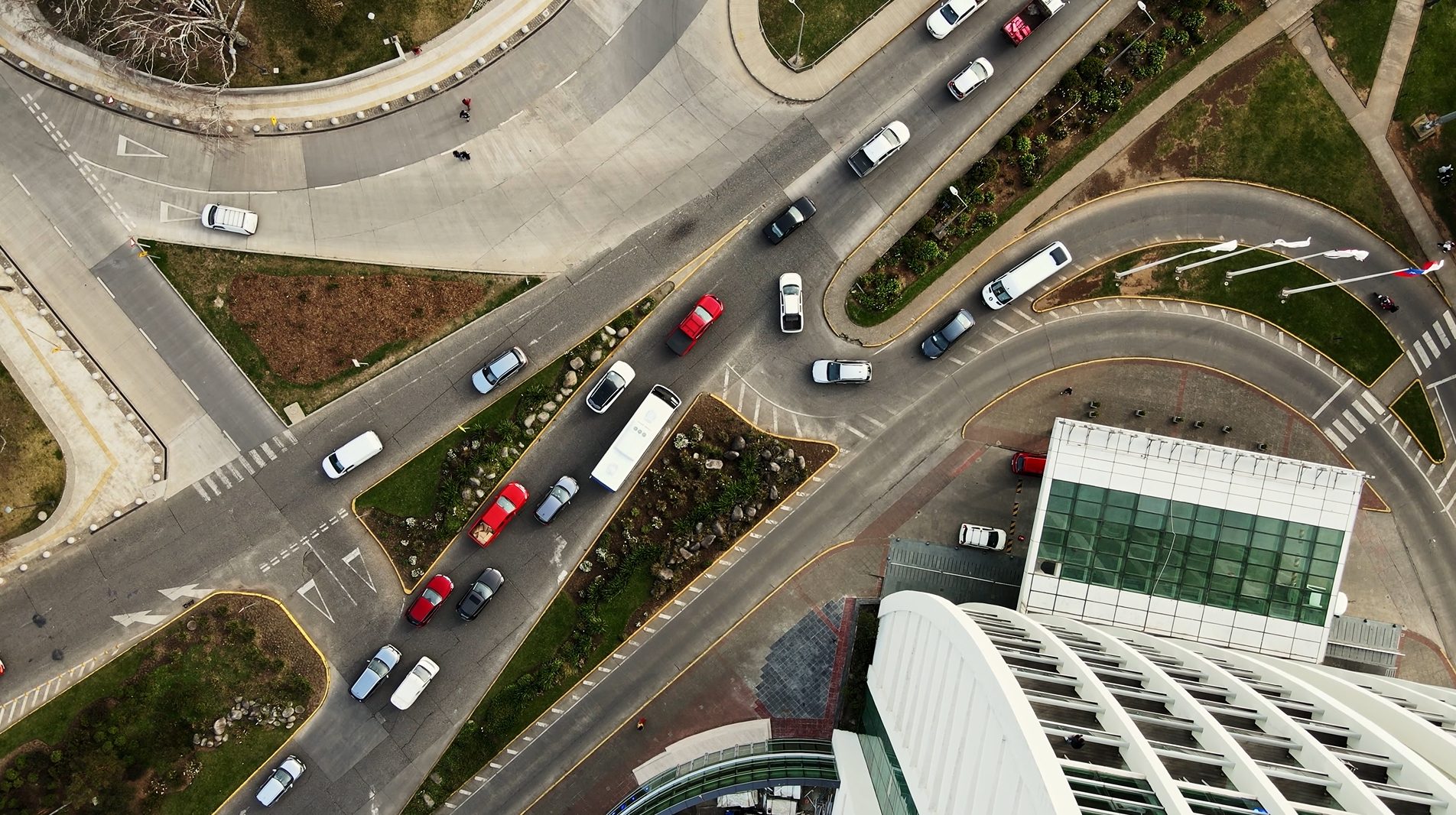
Road-construction monitoring, DPR preparation, bridge and building analysis, BIM modelling, encroachment analysis, asset management, pot-hole analysis and tree counting. The corridor map is the record those checks are drawn from.
Bridge and building analysis, encroachment review and asset records use the corridor survey as the base map.
Step by step
How a corridor is read
Illustrative sequence. Figures inside each clip are sample interface text, not a measured result.
-
01
Drone over the corridor
A stable, live aerial view of junctions and expressways opens the infrastructure workflow. Telemetry timestamps are sample interface text.
-
02
AI vehicle detection & counting
Cars, two-wheelers, buses, trucks and autos are counted by class at the junction. Class totals on screen are sample interface text.
-
03
Congestion heatmap & queues
See where traffic backs up — queue length per approach on a congestion heatmap. Queue metres and level-of-service letters are sample interface text.
-
04
Incident detection
Breakdowns and wrong-way vehicles are flagged in seconds on the live corridor view. Alert copy is sample interface text.
-
05
Traffic control dashboard
Signal timing suggestions and live corridor status help operators optimise the network. Green-time and speed figures are sample interface text.
Infrastructure & Highway Decision Matrix
From corridor aerial capture to DPR, BIM and construction progress intelligence
How Atrobot links linear corridor mapping, traffic analytics and 3D BIM verification for highways, bridges and rail projects.
-
Step 01 · Corridor Capture
Linear RTK/PPK Drone & LiDAR Survey
High-accuracy corridor flights over expressways, bridges and rail alignments supported by DGPS control networks.
Linear CorridorDGPS ControlLiDAR + RGBAI Layer · Terrain & BIMDTM Contours, Cross-Sections & BIM Alignment
Generates bare-earth elevation models, longitudinal profiles, cut/fill earthwork quantities and bridge/building geometry.
DSM / DTMCAD / BIMCross-SectionsImpact · DPR & DesignAccelerated DPR & Engineering Sign-Off
Provides survey-grade base maps, hydrology contours and land-acquisition layers in a fraction of conventional survey time.
Fast DPR DeliverySurvey Grade -
Step 02 · Construction & Traffic
Periodic Flyovers & Corridor Traffic Feeds
Scheduled progress flights and aerial corridor monitoring track earthwork, pier erection, pavement layers and traffic flow.
Epoch FlightsBridge & PierTraffic FlowAI Layer · Progress & Vision AIAs-Built vs. Design Variance & Flow Analysis
Overlays live 3D point clouds against BIM/CAD design models to flag schedule deviations, encroachments and bottlenecks.
BIM vs. As-BuiltEncroachment AIVolume CheckImpact · Cost & ScheduleEarly Deviation Alerts & Verified Billing
Project directors validate contractor earthwork claims and resolve right-of-way bottlenecks before they delay milestones.
Verified BoQOn-Time Milestones -
Step 03 · Asset Handover
Digital Twin Archival & O&M Workspace
Complete corridor orthomosaics, structural bridge models and right-of-way asset layers stored in cloud GIS.
Cloud GISAsset InventoryTime-SeriesAI Layer · Lifecycle AuditAutomated Defect & Pavement Condition Logs
Catalogues median assets, signage, drainage structures and surface distress for long-term highway maintenance.
Defect PinningSHP / GeoJSONAudit ReportsImpact · GovernancePermanent Digital Record for Authorities
Unified browser workspace for concessionaires, PMC teams and infrastructure authorities across the asset lifecycle.
Full TraceabilityMulti-Team Access
What this work covers
Corridor work follows the road or the structure. The survey is processed into the map used for construction monitoring, DPR preparation, bridge and building analysis, and BIM.
Encroachment, assets, pot-holes and trees are read from that same record. The outcome is the corridor file the team keeps, including the report in cloud storage.
- SurveyThe road or corridor
- InspectBridges, buildings, assets
- ModelBIM and the map
- RecordReport and cloud storage
- Road-construction monitoring
- DPR preparation for roads and other infrastructure
- Bridge analysis and building analysis
- BIM modelling
- Encroachment analysis and asset management
- Pot-hole analysis and tree counting
Survey work
FAQ
Frequently asked questions
Road-construction monitoring, DPR preparation, bridge and building analysis, BIM modelling, encroachment analysis, asset management, pot-hole analysis and tree counting.
Geospatial Visualisation & Analytics integrates CAD and BIM.
Next step
Request a Consultation
The enquiry goes to business@atrobot.in. You can also call +91-9319044881.